Arboretum Map Upgraded for Smartphones
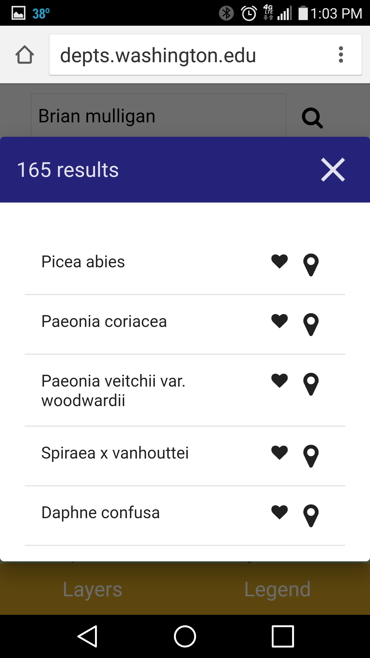
Have you even been deep inside Rhododendron Glen at the Washington Park Arboretum and wondered which direction you should walk to get to the Lookout Gazebo? Or maybe you were standing in front the most floriferous Hydrangea you have ever seen and can’t find the identification label? If you have a smartphone in your pocket then you can use the freshly upgraded map to see where you are and what plants are near by. You can also search for plants by name, keyword or accession number. Once you find a plant you love add it to your favorites. Next time you visit the Arboretum you can call up your list of favorites and see where each one is on the map.
The map was originally created in 2014 as part of a grant from the Institute of Museum and Library Services. The map worked well on desktop computers, but was challenging to use on small smartphone screens. To improve the utility of the map for visitors actually in the Arboretum the Botanic Gardens contracted with SpatialDev, a local GIS development firm, to redesign the map to be responsive to handheld devices and to utilize the GPS location function built in to every smartphone. The redesign was partially funded by a gift from the Northwest Horticultural Society.
Want to try it? There is no app to install. Simply go to the Botanic Gardens website (uwbotanicgardens.org) and navigate to the Interactive Map under the Gardens tab.
If you want to use it again why not make a shortcut and add it to your home screen?
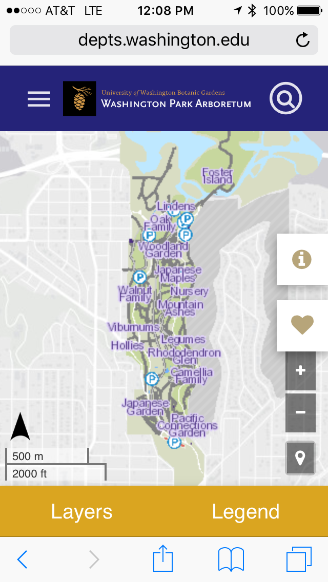
The map works on Android and Apple smartphones, tablets, and desktop computers
-
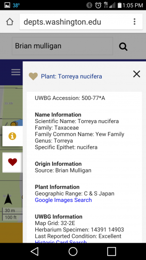
- See all the data about every plant in the Arboretum.

-
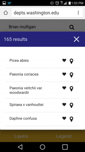
- Search for plants by name or keyword by clicking the magnifying glass icon.
-
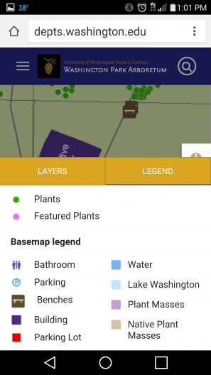
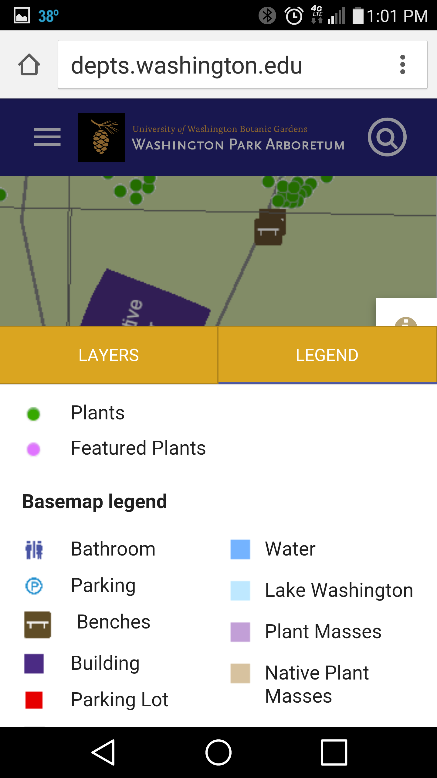
- See at a glance what the various icons and colors represent.